Deninger's route
The map below depicts the central part of Seram and was put together by Tauern using his own records as well as those of Deninger and Stresemann. Although it is not explicitely mentioned in the map legend, the red lines point to the paths that the expedition members took during their time on Seram.
At the same time, this and other maps clearly show how collected data was transferred into a matrix of knowledge visualization that is reflective of the colonial logic. Paul Langhans (1867-1952), who is mentioned on the bottom left of the document, supervised the creation of the map in his role as leading cartographer in the publishing house and editor in chief of Petermanns geographische Mitteilungen (1909-1937). Firmly rooted in the cartographic tradition of the 19th century, his maps were characterized by a high density of information that compressed multiple layers of space and time into a singular visual framework. While it was one of the most relevant German journals for the publication of geographic research at the time, Langhans ran it as a convinced anti-Semite and ideological pioneer of National Socialism. The maps informed by the II. Freiburg Moluccan Expedition and published in Petermanns geographische Mitteilungen were not created by Langhans himself, but rather produced under his supervision—yet his cartographic style is reflected in them.
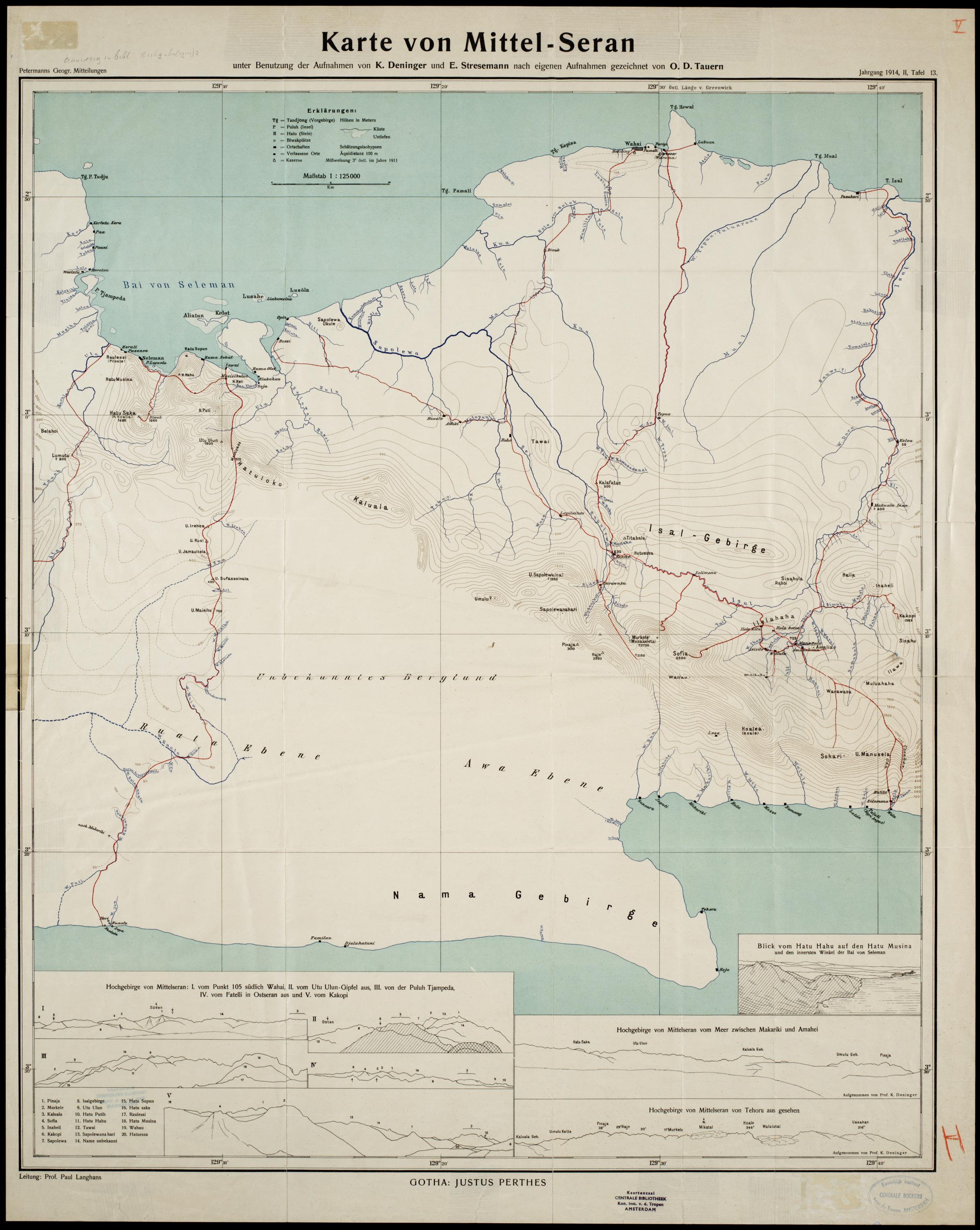
An overview map of Seram, edited by Deninger and Tauern, was also published in Petermanns Geographische Mitteilungen in 1914. It combines geographic with ethnographic information about the island. Another map depicts only the western part of Seram, designed by Deninger and published in Petermanns Geographische Mitteilungen a year later. This map combines findings of the II. Freiburg Moluccan Expedition, Dutch records of the Uli region, and the documentation of Lieutenant 1st Class W. K. H. Feiulleteau de Bruin, who had described his route between Honitetu and Kairatu. Interestingly, as indicated on the bottom right, this map explicitly includes the expedition routes.
______________
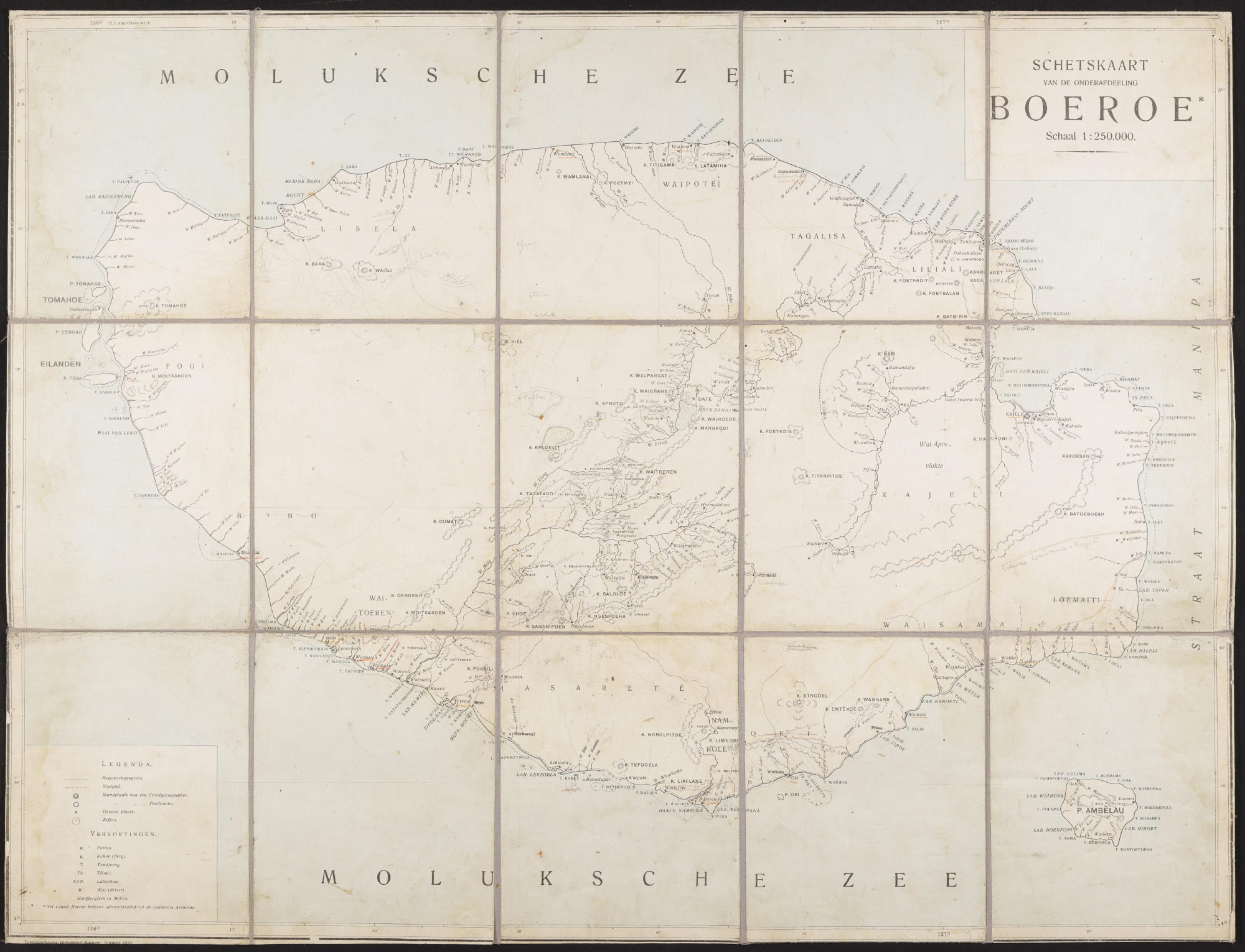
This folding map of Buru (Original title: Schetskaart van de onderafdeeling Boeroe) was published by the Topographische Inrichting Batavia. It is the map that Stresemann and Deninger had with them while traveling Buru, as markings and notes on the document indicate.
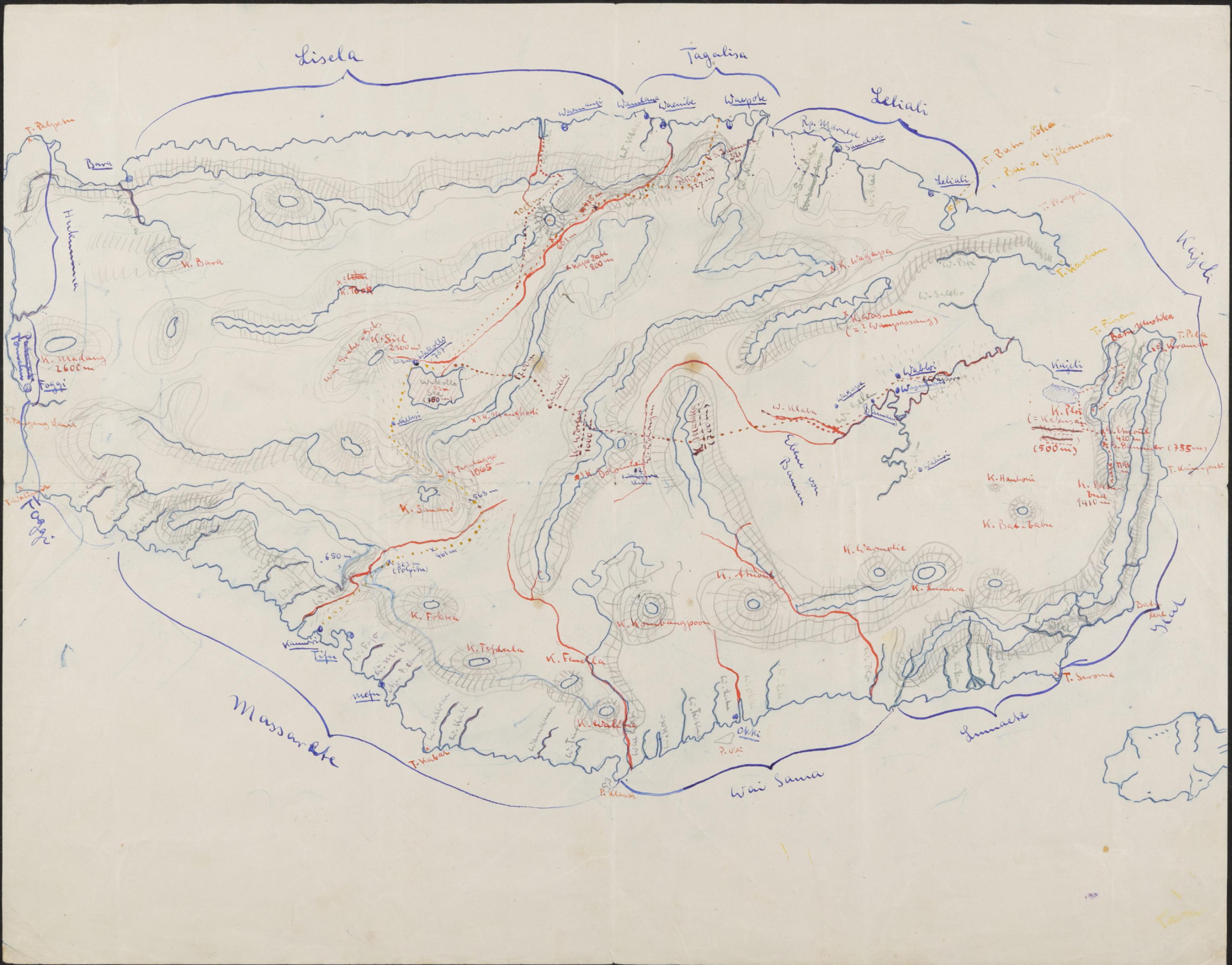
This handdrawn map of Buru was created by Deninger and/or Stresemann during their stay on Buru or after their return based on their notes. Upon comparison with the Dutch map above, it becomes apparent that Deninger and Stresemann added to existing cartographic knowledge of the island at the time.